
The NEO-6M GPS Module is widely used for location tracking in Arduino projects. In this detailed guide, we’ll explain how the NEO-6M GPS Module works, explore its features, pinout, wiring, and configuration. Learn step-by-step how to use the NEO-6M GPS Module with Arduino. The NEO-6M GPS Module makes satellite-based navigation simple, accurate, and affordable.
Introduction

Want to give your Arduino the ability to know exactly where it is on the planet?
The NEO-6M GPS module can do just that and more. This tiny but powerful GPS module is perfect for all sorts of exciting projects like:
Vehicle tracking
Data logging of movement routes
DIY drone navigation
Smart farming and IoT applications
What makes the NEO-6M so popular?
Easy to use with Arduino
Low power consumption
Affordable price
Reliable global coverage
In this project, we’ll learn how the NEO-6M GPS Module works, read real-time GPS data, and understand each of its components in detail.
How Does GPS Work?

GPS (Global Positioning System) is a satellite-based navigation system that helps devices determine their precise position on Earth.
Key facts about GPS satellites:
At least 24 satellites orbit Earth in the GPS constellation.
Satellites constantly broadcast radio signals.
Each signal contains:
The satellite’s exact position in space.
The precise time when the signal was transmitted.
Your GPS receiver (like the NEO-6M) listens to these signals. By measuring how long the signals take to arrive, it calculates distance from each satellite.
Through a process called trilateration:
With 3 satellites → Latitude & Longitude can be calculated.
With 4 satellites → Latitude, Longitude, and Altitude can be calculated.
This is how the GPS module provides accurate location and timing data.
Hardware Overview of NEO-6M GPS Module

1. NEO-6M GPS Chip
At the core of the module is the U-blox NEO-6M chip, designed for high-sensitivity GPS reception.
Tracks up to 22 satellites and 50 channels simultaneously
Sensitivity: –161 dB (can detect weak signals)
Startup times:
Cold start: ~27s
Warm start: ~25s
Hot start: ~1s
Communication: UART interface (default 9600 bps, up to 230,400 bps)
2. Position Fix LED
OFF / No blinking → Searching for satellites
Blinking once per second → Position fix achieved
3. Power Supply
Operating voltage: 2.7V–3.6V (with onboard 3.3V regulator)
Logic pins are 5V tolerant (safe with Arduino)
Current consumption:
Normal mode: ~45mA
Power Save Mode: ~11mA
4. Battery & EEPROM
Built-in small rechargeable battery + 4KB EEPROM
Stores:
Last known location
Satellite data
Settings
Enables Hot Start for fast GPS fixes (within ~1s)
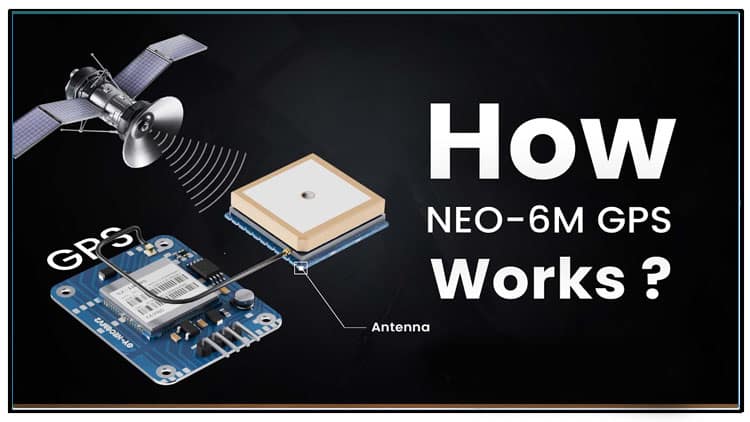
5. Antenna
Comes with a ceramic patch antenna (best for outdoor use)
U.FL connector available for attaching external active antenna
Pinout of NEO-6M GPS Module
| Pin | Function | Arduino Connection |
|---|---|---|
| VCC | Power Supply (3.3–5V) | 5V |
| GND | Ground | GND |
| TXD | Serial Data Output | RX Pin |
| RXD | Serial Data Input | TX Pin |
Materials for the Project
Circuit Diagram Explanation

The wiring is straightforward with just four connections:
VCC → 5V (Arduino power)
GND → GND
RX (Arduino 2 if using SoftwareSerial)
TX (Arduino pin 3 if using SoftwareSerial)
Tip: Always keep the GPS module in open sky or near a window for reliable satellite reception. Indoors, the signal is weak.
Step-by-Step Guide to Using NEO-6M with Arduino
Step 1: Wiring
Connect the GPS module to Arduino as per the circuit diagram.
Ensure correct RX–TX cross connections.
Step 2: Install Required Libraries
Open Arduino IDE → Go to Library Manager.
Install TinyGPS++ library.
Install SoftwareSerial library if using Uno/Nano.
Step 3: Upload Example Code
TinyGPSPlus gps;
Serial.begin(9600);
gpsSerial.begin(GPSBaud);
Serial.println(“NEO-6M GPS Module Test”);
}
while (gpsSerial.available() > 0) {
gps.encode(gpsSerial.read());
if (gps.location.isUpdated()) {
Serial.print(“Latitude: “);
Serial.println(gps.location.lat(), 6);
Serial.print(“Longitude: “);
Serial.println(gps.location.lng(), 6);
Serial.print(“Satellites: “);
Serial.println(gps.satellites.value());
Serial.print(“Altitude (m): “);
Serial.println(gps.altitude.meters());
Serial.println(“————————-“);
}
}
}
Step 4: Open Serial Monitor
Open Serial Monitor (9600 baud).
If outdoors, within 30 seconds you should see:
Latitude
Longitude
Number of satellites locked
Altitude
Using U-Center Software
The U-Center tool by U-blox is a professional GPS evaluation and configuration program.
Steps:
Connect the GPS module to PC using USB-to-TTL converter.
Open U-Center.
Select the correct COM port.
You can view:
Satellite constellation
Signal strength
Real-time position
Accuracy parameters
This tool is useful for advanced users who want to configure update rate, baud rate, and power-saving features.
Applications of NEO-6M GPS Module
Vehicle tracking systems
Fleet management
DIY drones & robotics
Geo-fencing applications
Smart agriculture monitoring
IoT weather & sensor stations
FAQs – How NEO-6M GPS Module Works
1. What is the operating voltage of the NEO-6M GPS Module?
It operates at 3.3–5V with onboard regulator.
2. How accurate is the NEO-6M GPS Module?
The accuracy is around 2.5m CEP outdoors with a clear view of the sky.
3. Can the NEO-6M GPS Module work indoors?
It requires satellite visibility, so indoors reception is usually weak or unavailable.
4. How NEO-6M GPS Module works with Arduino?
It sends NMEA sentences via UART to Arduino, which are decoded using libraries like TinyGPS++.
5. Does the NEO-6M GPS Module support external antenna?
Yes, it has a U.FL connector for an external active antenna.
6. How NEO-6M GPS Module works in vehicle tracking?
It continuously sends latitude and longitude, which can be stored or transmitted via GSM/GPRS.
7. How NEO-6M GPS Module works in drones?
It provides live coordinates for navigation and autonomous flight control.
Conclusion
The NEO-6M GPS Module is a simple yet powerful tool for adding GPS capability to Arduino projects. With just four connections and a few lines of code, you can track position, altitude, and movement in real time.
From vehicle tracking to IoT projects, this module is a must-have for makers who want to add location awareness to their systems.